|
|
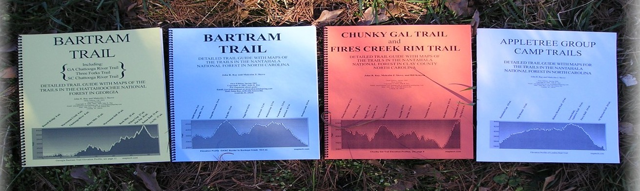
We have four trail guides available. Three of these are in 8.5x11
spiral bound
booklets. The three guides cover trails that are long enough for
backpacking trips
of several days. The fourth shorter guide is for the trails in the
Appletree Group
Campground area. These latter trails are used to connect the
Chunky Gal/Fires Creek Trail system to the NC Bartram Trail and the
Appalachian Trail at either Cheoah Bald near Robbinsville,
NC or Wayah Bald near Franklin, NC. Click sample to look at text in guides. Here is a sample of
one of the maps. The maps have a grid
of UTM coodinates which allows picking off coordinates of any point along the
trail. A brief description of the guides:
1. GA Bartram Trail Guide. Covers the GA Bartram Trail (37 mi.),
GA Chattooga River
Trail (11 mi.), GA Three Forks Trail (3 mi.) and SC Chattooga River Trail (20
mi.).
There trails are all connected. By doing the SC Chattooga River Trail,
part of
GA Bartram Trail and GA Chattooga River Trail one has a 40 mile backpacking
trip
along the Wild and Scenic Chattooga River. Reprinted 2020 with updates..
2. NC Bartram Trail Guide. Covers the NC Bartram Trail (60 mi.
plus 10 mile road walk
across Franklin, NC) from its southern end near Highlands, NC to its
termination
on Cheoah Bald. The southern trail head is at the termination point of
the GA Bartram
Trail on Hale Ridge Road. Intersects the Appalachian Trail at Wayah and
Cheoah Balds. Reprinted with updates 2021.
3. Chunky Gal/Fires Creek Rim Trail Guide. Covers the Chunky Gal
Trail (21 mi.) starting
near Deep Gal and Standing Indian Mtn. west of Franklin, NC to its
termination
point on the Fires Creek Rim Trail on Tusquitee Bald (5200 ft.). Also
covers the Fires
Creek Rim Trail (26 mi.) and side trlails down into the Fires Creek
Basin.
The road structure of the main roads in the Basin are also shown to allow for
day-hike
explorations. Also, the Old Road Gap Trail which leads down from County
Corners
to Junaluska Gap is included. Old Road Gap Trail allows connection to
the Appletree Trails and
to the NC Bartram Trail. Maps for the Appletree Trails but no detailed
discussion
is given of the Appletree Trails which are used to connect to the NC Bartram
Trail
and the Appalachian Trail. These trails are not as well maintained as
the Bartram Trail and you need to be an experienced hiker/backpacker to attempt these trails.
Reprinted with updates 2018.
4. Appletree Trail Guide. This contains the maps and detailed
discussion for the trail in the Appletree Camp Area (26 mi.). These
trails are associated with the Group Campground and can be used to connect
Fires Creek to the Bartram and Appalachian Trails.
The guides contain GPS generated TOPO maps with the mileage shown on the
maps.
The TOPO maps are constructed using Terrain Navigator Pro from MyTopo.com.
Highlights are tied to the mileage and have a resolution of a few tenths of a
mile.
You may purchase the guides in a few stores in GA, and NC. Please
check before you go because they sometimes run out.
You may also
order by USPS mail directly from John Ray by sending a check or money order
for the amounts quoted below. The prices quoted below include shipping
and handling.
The guides are also carried on amazon.com (higher price) if you
want to order by credit card. You can also pay me with paypal if
you have a paypal account, email me for information about how to order using
paypal,
Make payment to John Ray.
John R Ray
1190 Old Seneca Rd
Central, SC 29630-9593
864-868-2749
johnrraya@gmail.com
PRICES:
GA BARTRAM
GUIDE
$13.00
NC BARTRAM
GUIDE
$13.00
CHUNKY GAL/FIRES CREEK $14.00
APPLETREE
GUIDE
$5.00
FOR ALL FOUR
GUIDES $40.00
All prices include shipping and handling.
Disclaimers: We have tried to make these
guides as helpful and as accurate as possible, but there are inherent dangers
and the possibility of getting lost, running out of water, encountering wild
animals, and being injured or sick when entering into any area the trail
passes through. We encourage all hikers to obtain the USGS maps of the area
you are hiking and learn to use these with a compass to navigate in the
forest. Driving on Forest Service roads may be more dangerous than on normal
highways since they do not have the same safety standards. We are not
responsible for accidents that occur on Forest Service roads mentioned in
this guide. We are not responsible for injuries or accidents that occur while
using this guide. The parking areas mentioned in the guide are not secure.
This is a serious problem for backpackers for which we do not have a good
solution. We are not responsible for losses due to vandalism or theft from
parking areas mentioned in this guide, although we ourselves have not
experienced any theft or vandalism. These trails have strenuous ascents and
steep descents. Make sure you are in excellent physical condition before
attempting to hike these trails. You cannot count on cell phone use from the
trail, connections are spotty at best. Treat all water that you do not bring
with you. Tell someone exactly where you are going or better travel with
others. In the Bartram guides
we mention where you can attempt to arrange shuttles. We have not
checked out the drivers at these locations and have no knowledge of their
insurance and driving records. Hikers who rides with any driver, volunteer or
commercial, accepts responsibility for his or her own safety and agrees to
not hold the authors responsible for their safety.
Back to home
|
|